About Geoconnex
Learn about the water data knowledge graph Geoconnex.
Geoconnex aims to make water data as easily discoverable, accessible, and usable as possible.
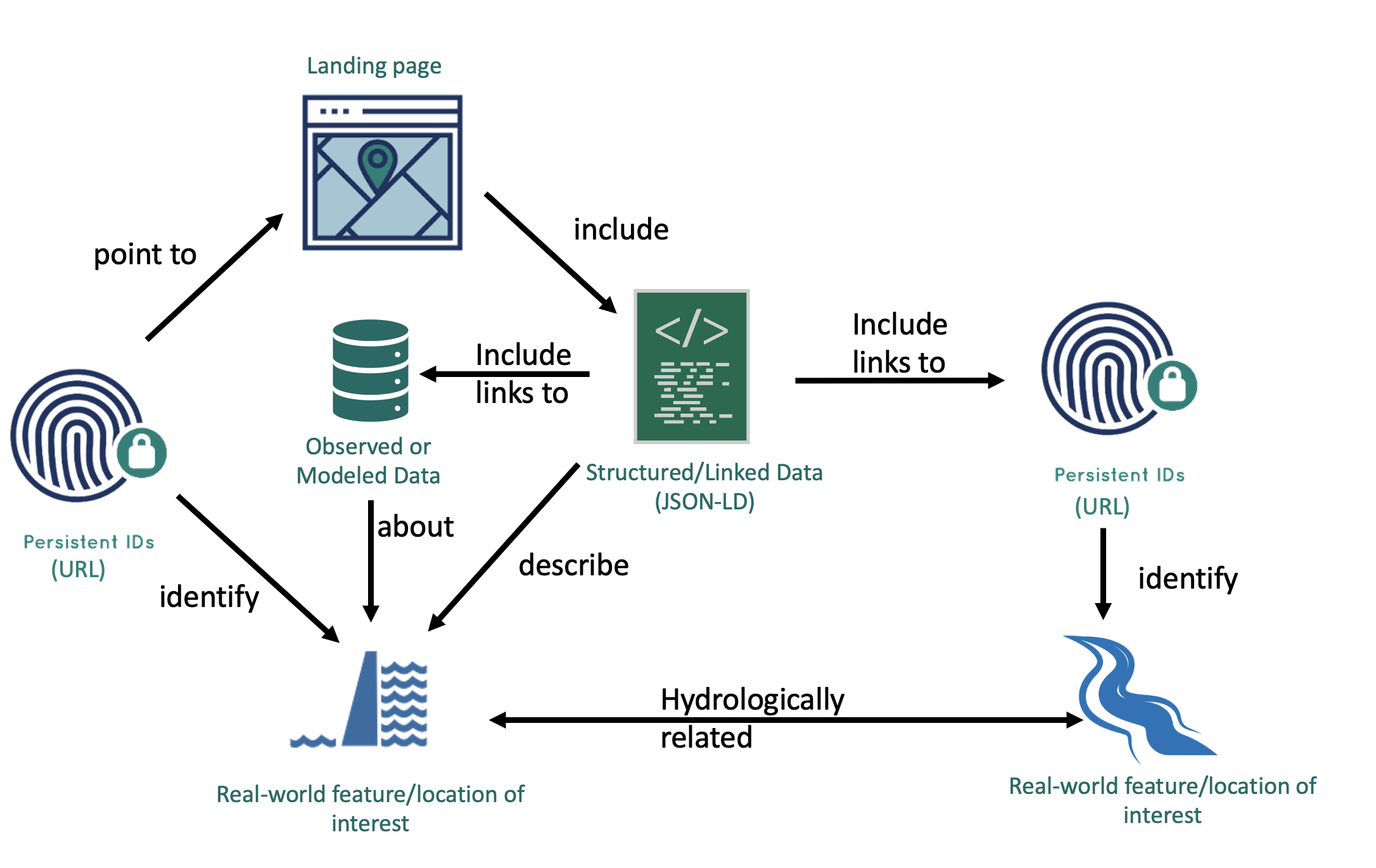
The Geoconnex project provides technical infrastructure and guidance for creating an open, community-contribution model for a knowledge graph linking hydrologic features, published in accordance with Spatial Data on the Web best practices as an implementation of Internet of Water principles.
The CKAN-Geoconnex integration is built in collaboration between datHere, the Center for Geospatial Solutions, and the United States Geological Survey.
Sync your CKAN water data hub with Geoconnex
Explore CKAN-Geoconnex features
Explore the Geoconnex features your CKAN instance receives when enabling the Geoconnex integration.
Enable the Geoconnex integration
Learn how to enable the Geoconnex integration for your CKAN instance to sync water data.
Software architecture
Learn about the software systems running as infrastructure for the CKAN-Geoconnex integration.
Learn more about Geoconnex
Read about Geoconnex through the online documentation.