Features
Learn about the various features available in the ckanext-gztr CKAN extension.
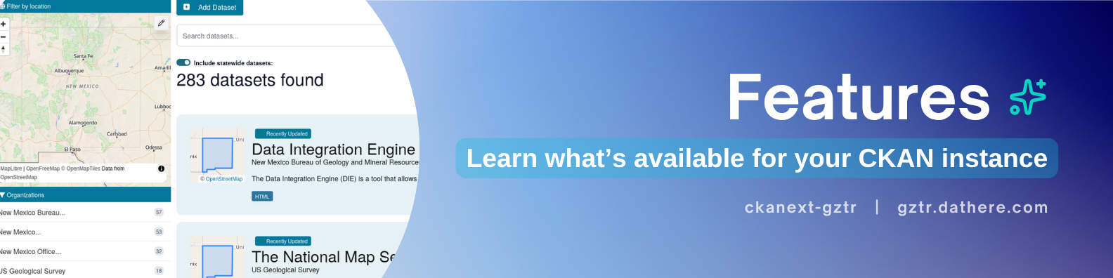
For features that do not exist within ckanext-gztr, please request a feature by adding an issue on GitHub or explore alternative extensions such as:
- ckanext-spatial - Official CKAN extension for adding geospatial capabilities to CKAN
- ckanext-geoview - Official extension to display geospatial files and services in CKAN
Now let's explore the features for your CKAN instance added by ckanext-gztr!
Note
Public dataset search gazetteer
Commonly, CKAN data catalogs have a search box where users may type their query for datasets they'd like to find. However, this can be cumbersome when it comes to geographic data, when there is no visual method to search and identify relevant regions. The public search gazetteer helps resolve this issue by providing an interactive map where users can draw a bounding box to search for datasets that have (simplified) geospatial features which intersect with their drawn bounding box.
The search uses simplified geometries
Here are things you can do with the public search gazetteer:
- Search for datasets by drawing a bounding box region on an interactive map
- Identify various named places as features on a map (e.g. cities, counties, etc.)
- View datasets with geographic data using interactive thumbnails
- Explore an interactive map of a preset region
- Filter between excluding and including datasets about a common "quick extent" region (e.g. statewide)
- Search for an address using the Nominatim API
- Search datasets by a named place keyword (e.g. a city name)
Dataset publisher gazetteer
A signature feature of ckanext-gztr, the dataset publisher gazetteer provides dataset publishers a visual and interactive way to specify a dataset's relevant geographic features. Users can either select pre-loaded features or draw custom polygons. The selection is then saved and can be searched from the public dataset search page, either by drawing a bounding box using the public search gazetteer or by searching a pre-loaded location's name, which can be indexed as a “place keyword”.
Public search minimaps
Once a dataset publisher associates a dataset with geospatial data using the data publisher gazetteer and publishes the dataset, a minimap can be displayed on each dataset with an association in the search results and also on the dataset landing page.
For example here is a datasets page, where there is a minimap depicting the selected geospatial region by the data publisher on the left of each dataset that appears in the search results:
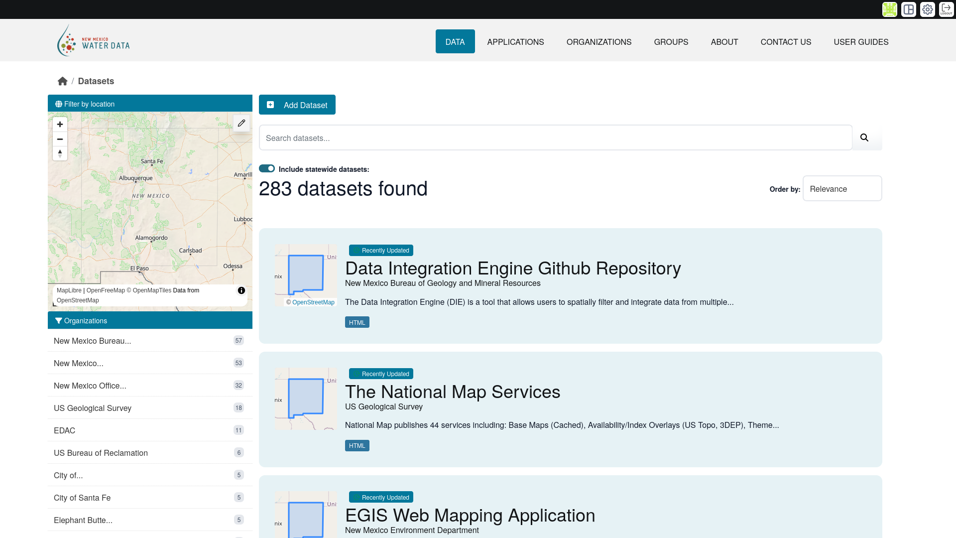
Here's a closer look at a single dataset search result:

This minimap feature can help visually identify datasets that have specific geospatial features as a public user.
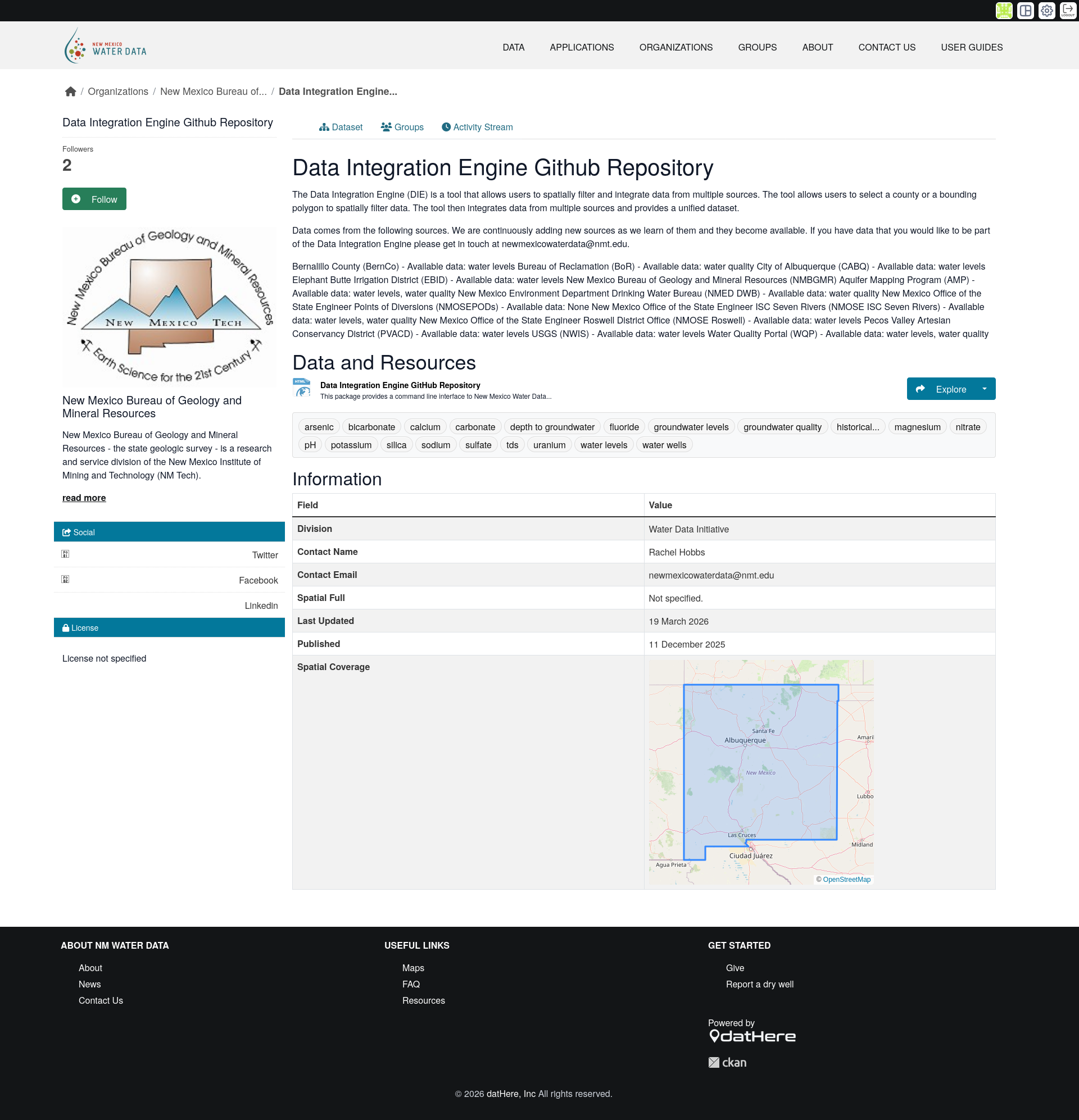
Here is the minimap that can also be displayed on a dataset's landing page (i.e. when clicking on a dataset in the search results). For example here is a dataset's landing page, where there is a minimap in the metadata section at the bottom:
Place keywords search
When a sysadmin of a CKAN instance provides preset geospatial collection for associating datasets with geospatial features, users can query by the geospatial feature's human-readable names.
For example if a dataset publisher selects the "Counties" geospatial feature collection and then selects "County A" and "County B", then the the user can search for those counties by name in the default CKAN dataset search page.
As with various features throughout ckanext-gztr, the place keywords search can be enabled or disabled by the CKAN instance's sysadmin(s).
STAC API

ckanext-gztr is being built with the SpatioTemporal Assets Catalog (STAC) (suite of) specification(s) in mind regarding its geospatial data organization. This allows for better interoperability while also supporting long-term extension usage and customizability.
One of the benefits of this implementation is exposing a STAC API for your geospatial collections. Here is a summary of the endpoints that are made publicly available for your CKAN instance once ckanext-gztr is installed:
| Endpoint | Summary |
|---|---|
/gztr/stac | Returns the STAC Catalog (catalog.json in the gztr storage) as JSON |
/gztr/stac/collections | Returns a list of STAC Collection metadata as JSON |
/gztr/stac/collections/{collection_id} | Returns a specific STAC Collection's metadata as JSON |
/gztr/stac/collections/{collection_id}/items | Returns a STAC ItemCollection (based on GeoJSON FeatureCollection) for a specific STAC Collection as GeoJSON |
/gztr/stac/collections/{collection_id}/items/{item_id} | Returns a STAC Item (based on GeoJSON Feature) for a specific STAC Item as GeoJSON |
Currently the STAC API /search endpoint and validation are not implemented with ckanext-gztr.
You can visit the API reference section in the navigation sidebar/menu to view the available API endpoints along with using an interactive Postman-like GUI.
Note
gztr_* Action API endpoints
There are several CKAN Action API endpoints added with ckanext-gztr installed on your CKAN instance.
gztr_collection_create - Upload a geospatial collection as GeoJSON to store as GeoParquet
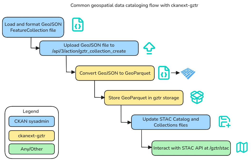
The /api/3/action/gztr_collection_create CKAN Action API endpoint is provided for convenience and is used as documented in the installation section. This endpoint is based on the CKAN /api/3/action/file_create CKAN API Action but also adds a conversion step as it expects a GeoJSON file storing a FeatureCollection as input and then converts the data to GeoParquet and stores it in the gztr storage. You can learn more about how it's used in the installation section up next.
Geoconnex integration

For CKAN instances storing water data, you can sync your water data with the Geoconnex knowledge graph.
Read the Geoconnex integration section to learn more.
Get started with ckanext-gztr for your CKAN instance
Ready to add geospatial capabilities to your CKAN instance? Get started by installing ckanext-gztr.